Amazon FSX version in temporary version for MSFS2020 %)))
More real coordinates
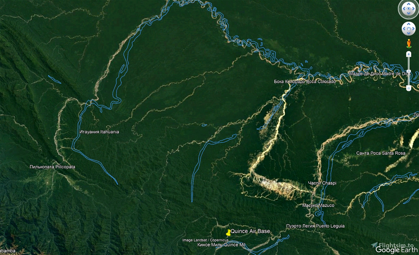
There are only 4 runways: SPIL, SPQ1, SPQ2, SPQ3.
All runways, even on the water, have ILS. %).
ILS frequencies are invented by me.
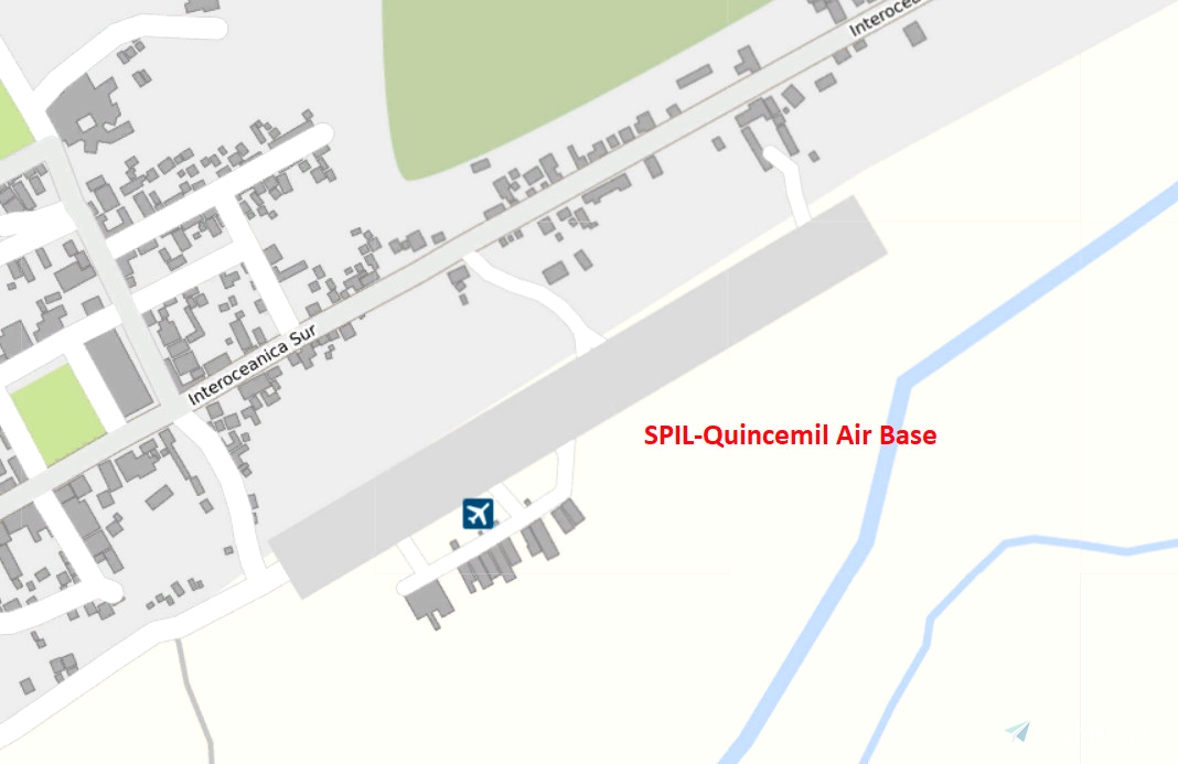
I don't have a photo of the airport. There is no SPIL in google map. There is only Open Map. I invented everything myself.
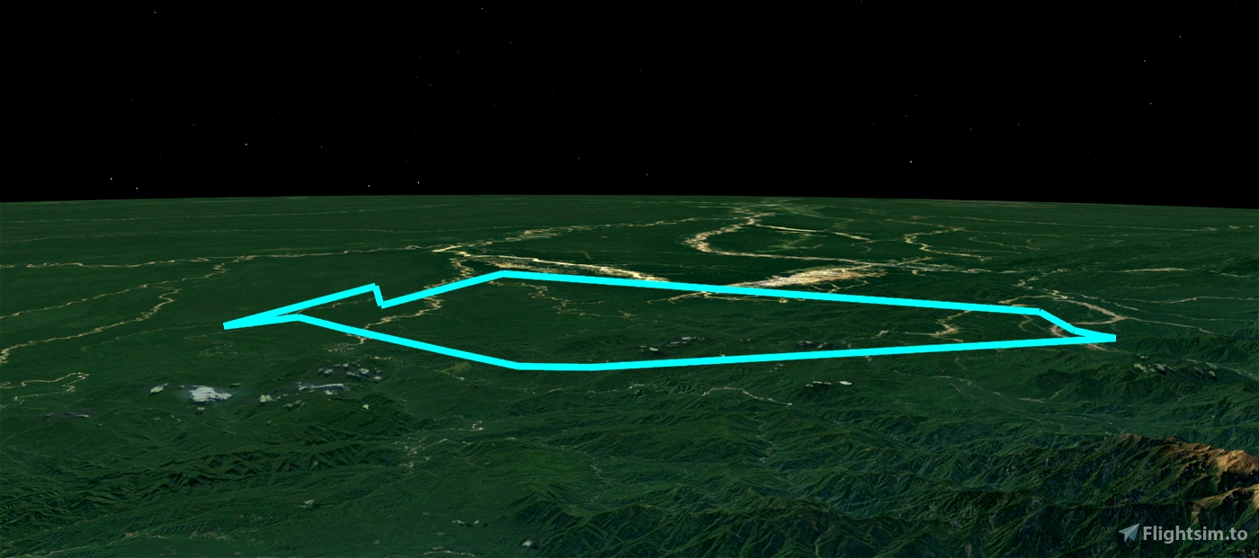
There is a flight plan. You can use autopilot. First via NAV, then APP and landing via ILS.
ILS is available on all runways.
We only care about altitude and speed.
Aircraft selection. I do not think that the task should have a restriction on aircraft. Pilot can fly whatever he likes.
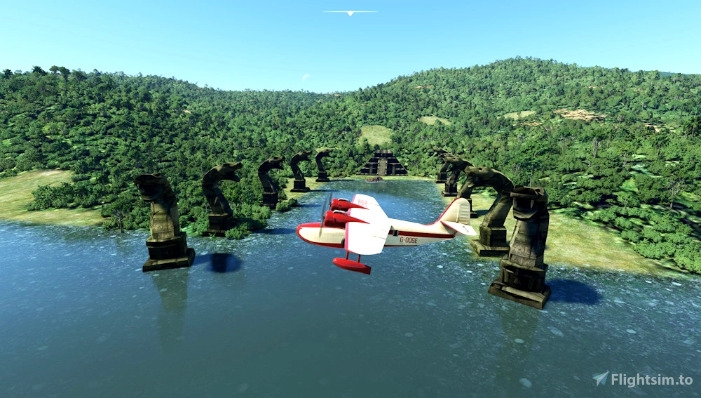
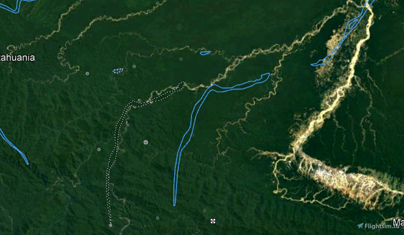
Made for the Bing map. There are no water bodies on the map. They had to be added. The place where the temple is - on the Bing map in MSFS2020, the river has completely dried up.
All that was left was a dry stream.
Google maps still show bodies of water with offset coordinates. And if we combine the displaced areas, we will see their real position.
The coordinates of water bodies and touchdown points are almost the same as in the FSX version.
The village on the lake has grown and grown rich in 40 years thanks to FSX!
Complete the mission at night. Cool!
Statues with snakes glow. I don't know how to turn them off.
I have nothing against if someone wants to improve or change the mission.
That's why I'm posting the source code.
I will be able to improve this version when "BushTripInjector" allows you to add airports that are not in MSFS.
Probably ASOBO would have done it better.
The installation is normal - copy everything to the community folder.
Special thanks to BuffyGC for his work on BushTripInjector, which is what I used to create this bush trip.
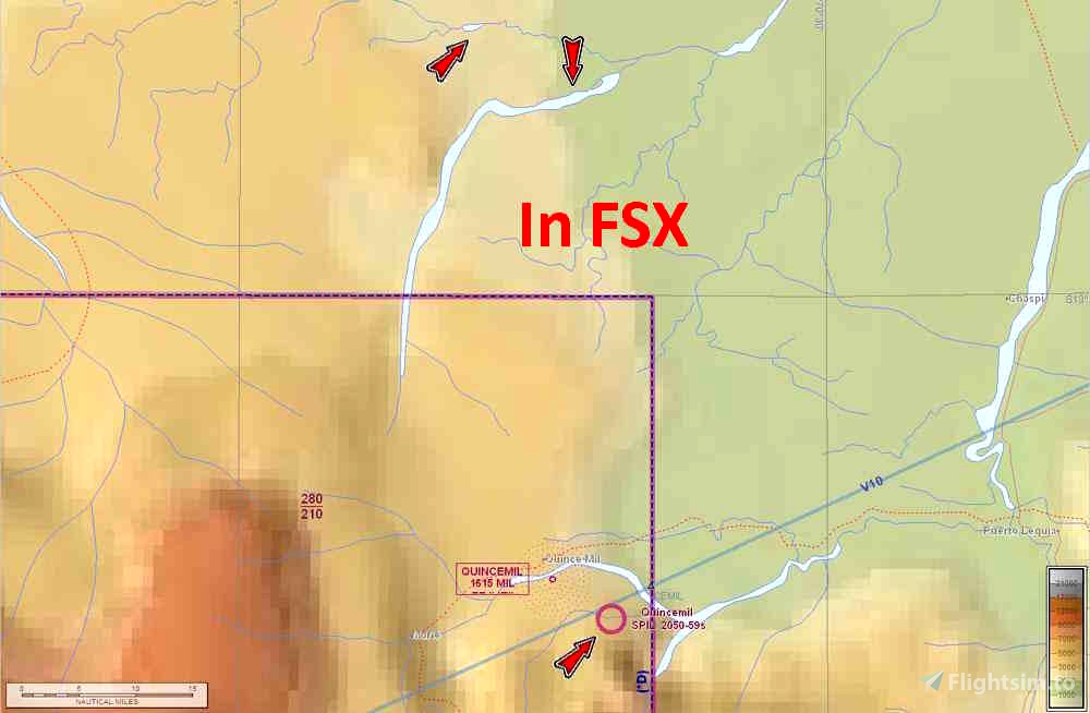
SPIL-Quincemil SPQ1-Base camp SPQ2 - Village Lake SPQ3 - Snakes Temple
ALT's 2120 F 1054 F 1494 F 1494 F
LENGTH 800 M
MAGVAR's 7.6° 8° 8° 8.1°
APPROACH's min ALT ! 4100 F 3100 F 3300 F 3500 F
APPROACH's max ALT ! 5100 F 4100 F 4300 F 4500 F
RUNWAY's RW07 RW25 RW09 RW27 RW09 RW27 RW03 RW21
ILS's "QM07" "QM25" "BC09" "BC27" "VL09" "VL27" "TS03" "TS21"
Freq's, MHz 110.10 110.15 110.30 110.35 111.20 111.25 111.30 111.35
Headings's 67° 247° 93° 273° 91° 271° 31° 211°
Pitch 5.7 2.5° 3° 3° 3° 3° 4° 2.5°
FSX миссия "На далёкой Амазонке" в современном исполнении для MSFS2020 %)))
Более ревльные координаты.
ВПП всего 4: SPIL, SPQ1, SPQ2, SPQ3.
На всех ВПП, даже на воде, есть ILS. %).
Частоты ILS придуманы мной.
У меня нет фото аэропорта. SPIL в google map нет. Есть только в Open Map. Всё выдумал сам.
Есть план полёта. Можно использовать автопилот. Сначала по NAV, потом APP и приземляться по ILS.
ILS есть на всех.
Следим только за высотой и скоростью.
Выбор самолётов. Не думаю, что в задании должно быть ограничение по самолётам. Пилот может лететь на том, что ему нравится.
Делалось для карты Bing. На карте нет нужных водоёмов. Их пришлось добавить. Место где храм - на карте Bing в MSFS2020 река вообще высохла.
Осталось только сухое русло.
Карты гугл до сих пор показывают водоёмы со смещением координат. И если совместить смещённые области то увидим их реальное положение.
Координаты водоёмов и точек приземления почти как в версии для FSX.
Деревня на озере за 40 лет разрослась и разбогатела благодаря FSX!
Выполните задание ночью. Прикольно!
Статуи со змеями светятся. Не знаю как их "потушить".
Ничего не имею против если кто-то захочет улучшить или изменить миссию.
Поэтому выкладываю исходный код.
Установка обычная - скопируйте всё в папку community.
Смогу улучшить эту версию, когда "BushTripInjector" позволит добавлять аэропорты, которых нет в MSFS.
Наверное ASOBO это сделали бы лучше.

8 months ago
8 months ago
Wet10
icarrus