


Distance:285km.Length:1.45-2.45h. .
Difficulty: Medium. ...
Autor map and weather:B21 / MSGamerTag01 (SSC Alsek River 340)
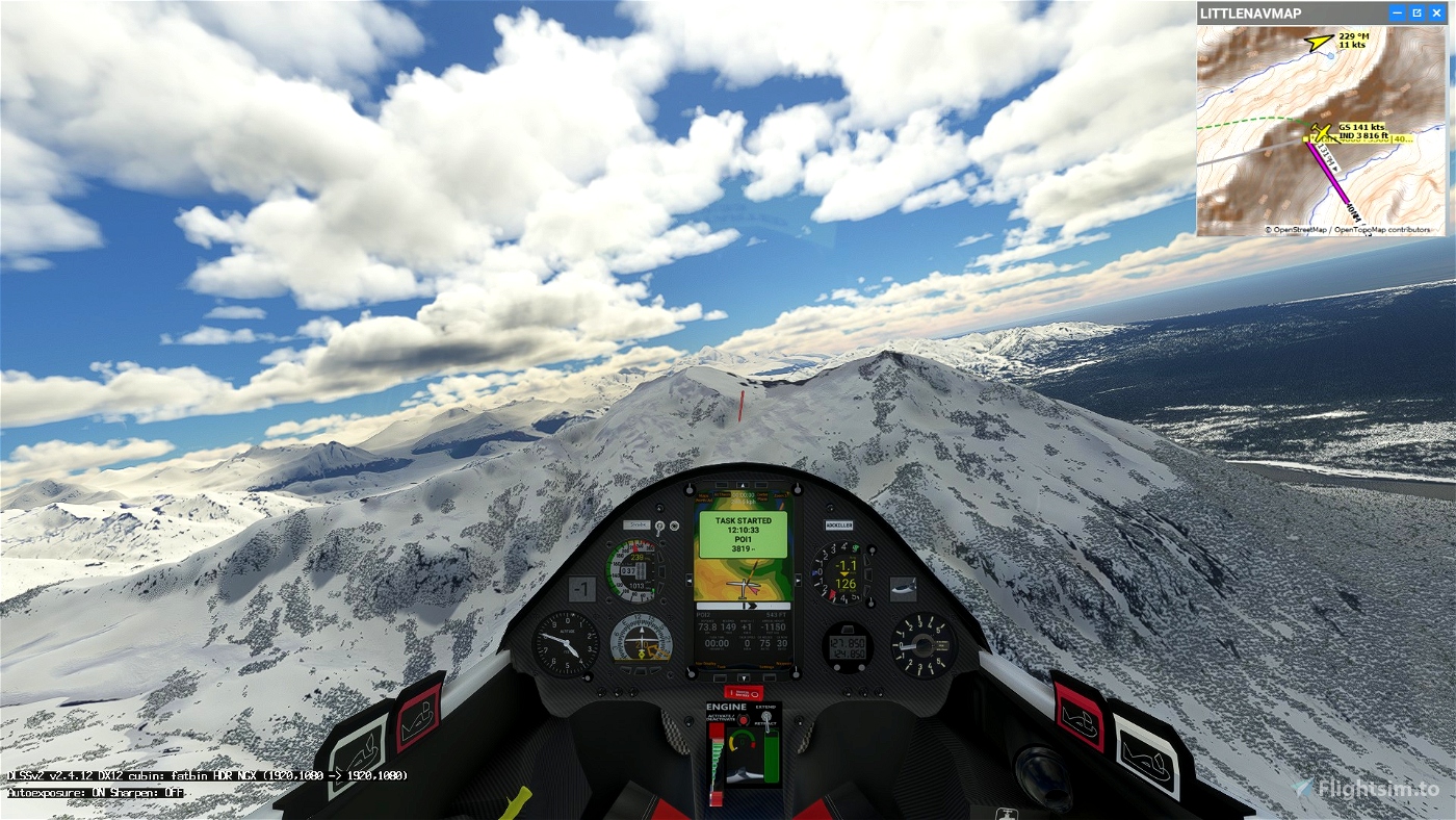
Gliding in the Alaska.
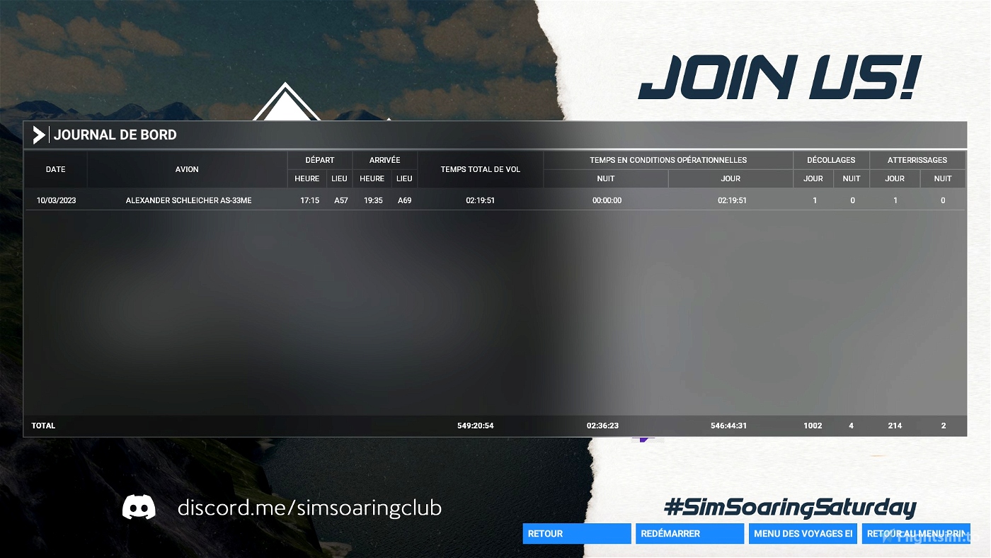
Departure: A57 Alsek River
Arrival: A69 Tanis Mesa
Soaring Type: Ridge
Weather report:
Clouds are scattered, reasonably high so not really a factor.
Ridges can be expected to be working well, in spite of the relatively modest wind.
Notes:
MAX START HEIGHT as in task is 4000 feet (1220 meters). As reminder, start WP is labelled "Start 4000".
----
Use and look to GPS to validate all crossing points (notification when done).
Watch your GPS and wait for the map to finish loading.
Then adjust the GPS on the A57 tab .
Use your engine to take off.
Pass over the aerodrome to valid A57
Make sure that you have validated the crossing point above the aerodrome.
Use and look to GPS to validate all crossing points (notification when done).
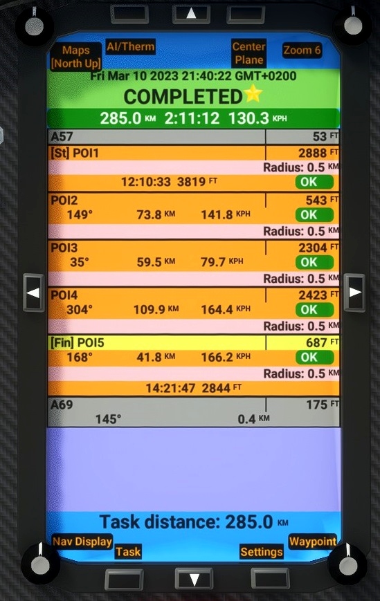
4000 FEET Maximum height to pass the POI1 start line.
---------------
A57 Kiteni 53
POI1: Starting line. Elevation 4000 FEET maxi
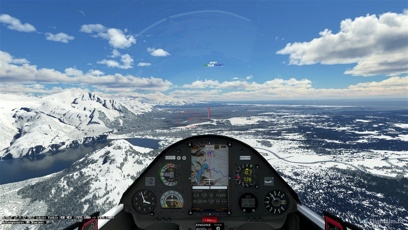
POI2: Fish Lake Elevation 46 feet
POI3: Mount Barnard Elevation 1693 feet
POI4: Yakutat Glacier Elevation 1991 feet
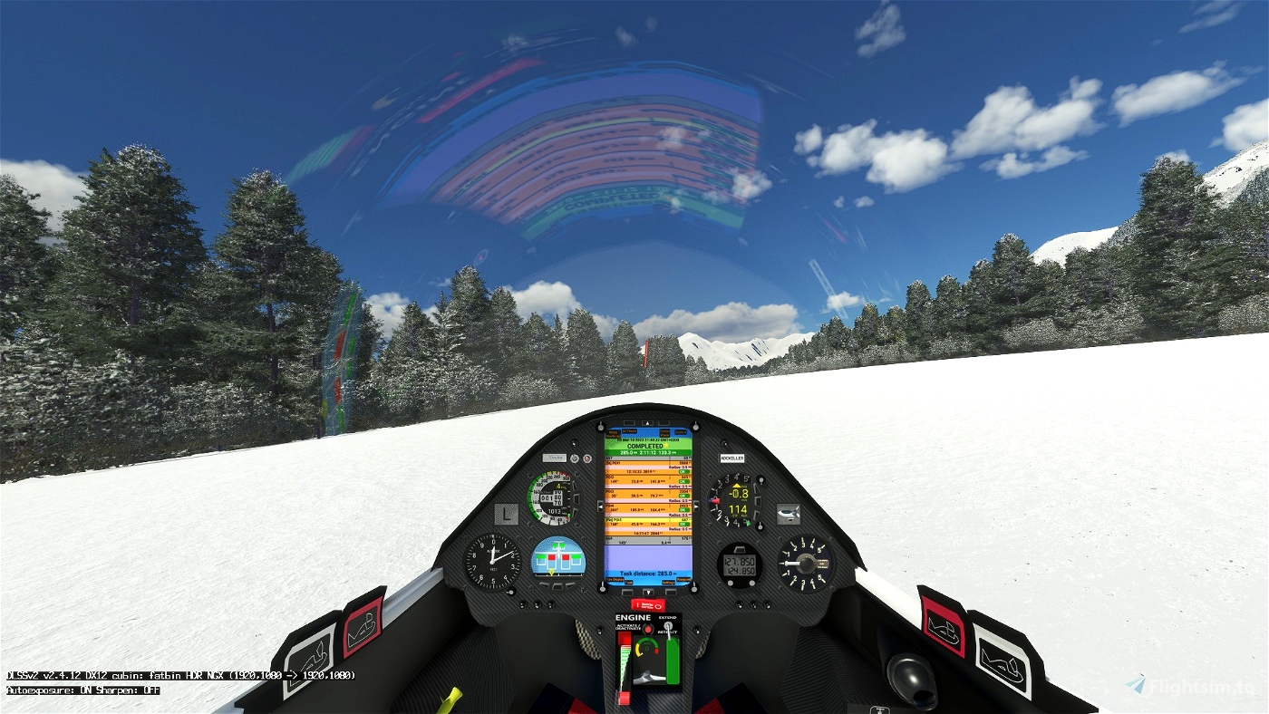
POI5: Finish line. Elevation 180 feet
Landing on the airport of Tanis Mesa - A69 175 feet.
Turn off your main battery when you have landed
---------------------------
MADoloSimulations
ASS33 me 1.83
https://fr.flightsim.to/file/15090/as-33-me
MSFS2020 Map Enhancement » Microsoft Flight Simulator
SCC Sim Soaring Club
https://discord.com/invite/8TaW8QjH
https://www.twitch.tv/videos/1534299342
https://www.youtube.com/GeorgOrtner
https://www.instagram.com/simsoaringclub/
Glider Archives - ALBATROSS Racing Club (albatross-racing.club)

 ADCKillerman

