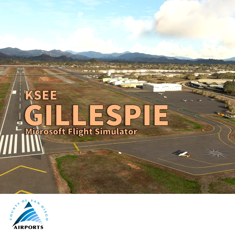


Gillespie Field (ICAO:KSEE) is a county-owned public towered airport, 12 miles northeast downtown San Diego and the beach in California. The airport is mostly used for general aviation, with 3 runways. Gillespie is the home of San Diego Air & Space Museum Annex, the ASTREA (the air support unit of the San Diego County Sheriff's Department) and a dozen of other businesses and flight clubs/schools like my club Plus One Flyers.
As for all of my MSFS mod, this small scenery is made from a pilot-eyes perspective. In real, I'm a Plus One Flyers member and mostly fly from Montgomery Field but Gillespie is one of the fourth base. I'm real PPL but a rookie amateur scenery developer: this mod is made with 99% of MSFS default objects library and feature massive number of details. The scenery is inspired by some of my personal videos and pictures, the FAA From the Flight Deck - Gillespie Field Airport, but mostly by high resolution aerial views from Bing and Google maps. It's a mix between the satellite imagery displayed from MSFS and more accurate data found on Internet. 1800+ objects have been added to the default scenery to make in more live and bring a touch of an active area.
Features
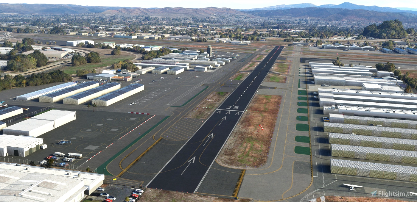
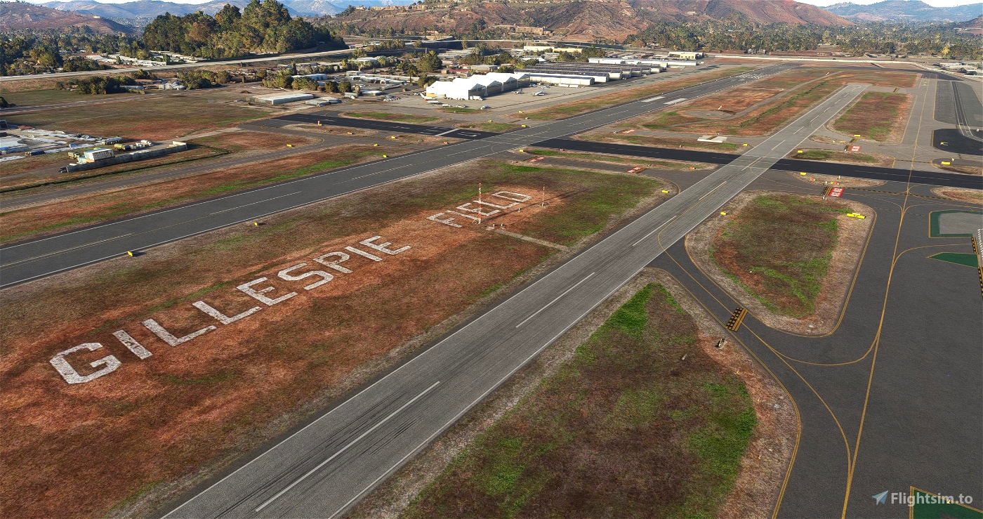
- Taxiways : all corrected and fixed
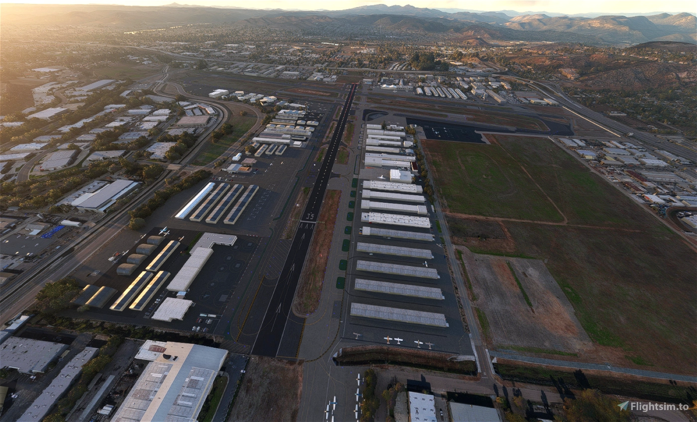
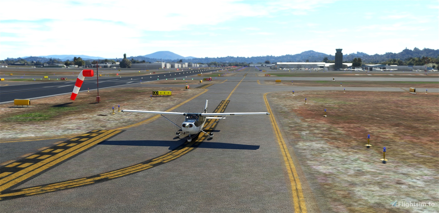
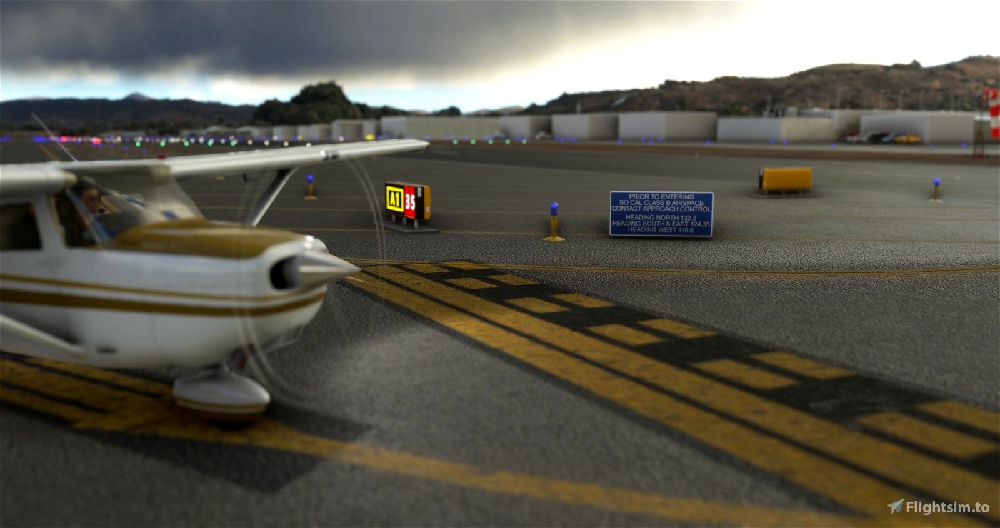
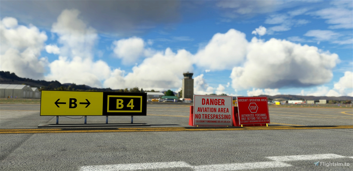
- 150+ taxiway signs : complete redesign, correct name according to uptodate charts, add some of the two sided taxiway signs (example at D5).
- Taxiway lines: complete redesign, position and correct, add "center line enhanced" represented 1400+ taxiway paths.
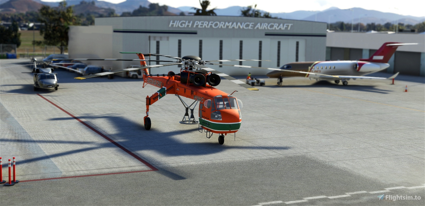
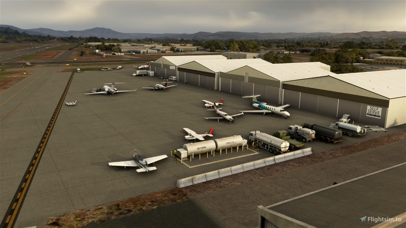
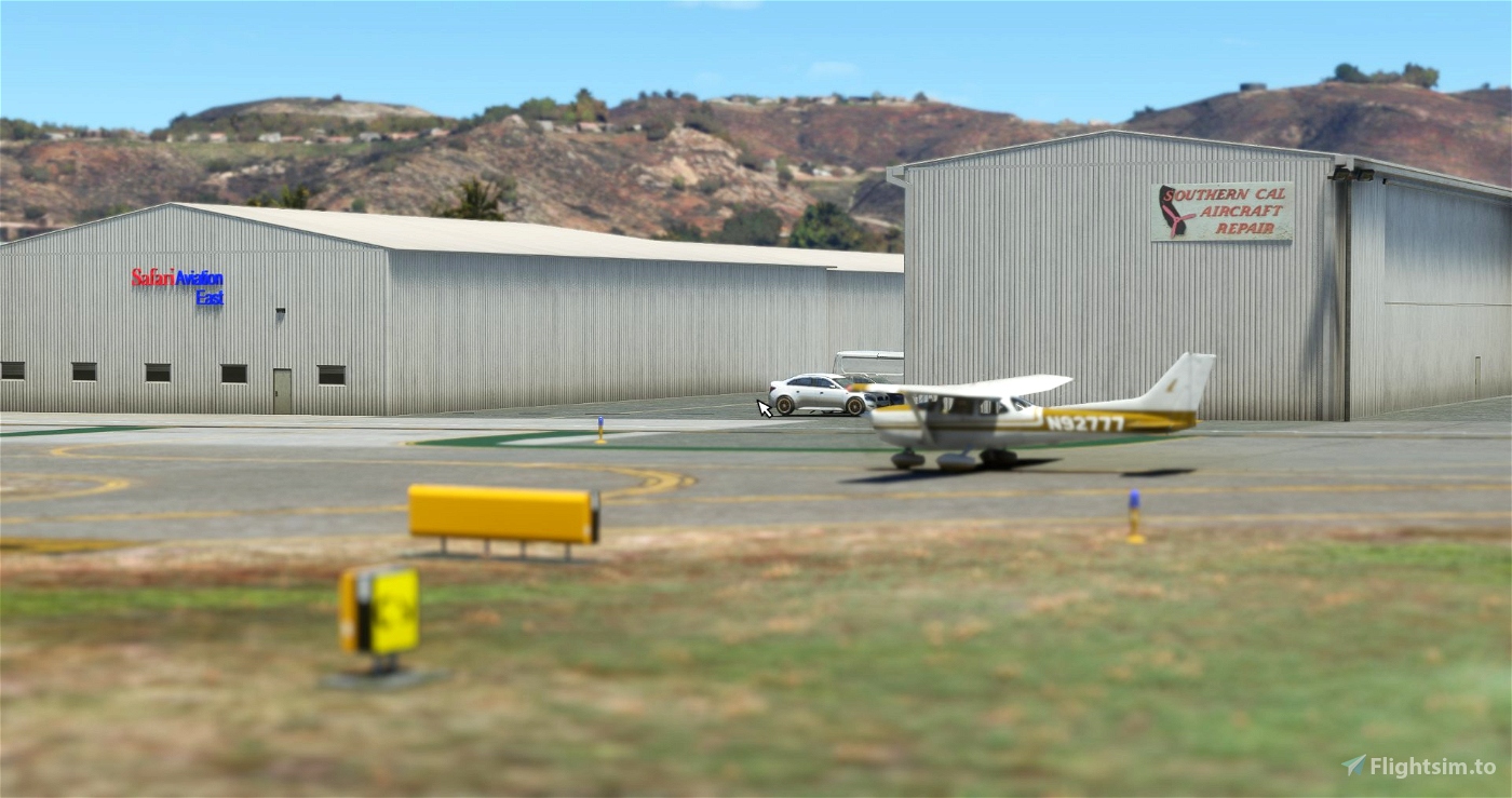
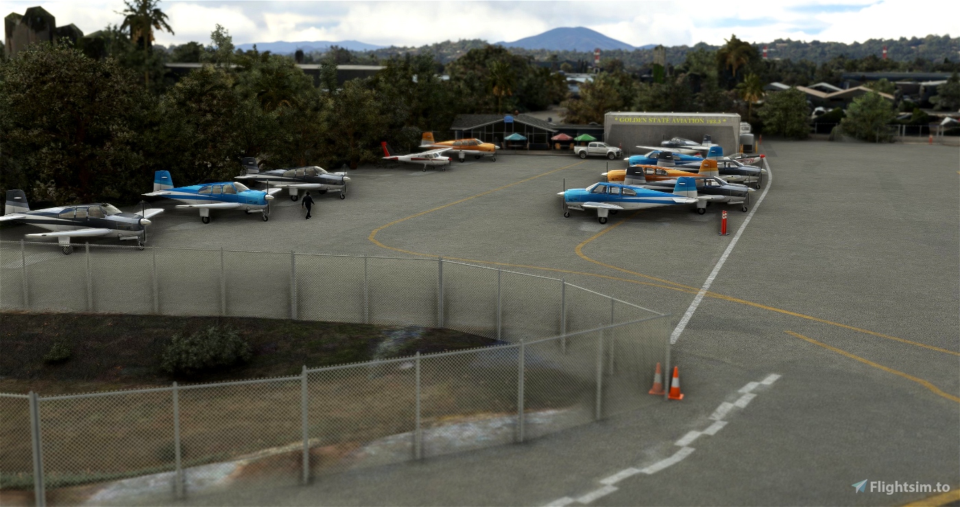
- Buildings: all airport hangars/FBO's and buildings have been replaced by MSFS objects library: Speer Hangar Assoc, Allen Airways Flying Museum, California Flight Academy, American Aviation Academy, SAA (Scandinavian Aviation Academy), ASTREA, Golden State Flying Club, Safari Aviation, Southern Cal Aircraft, High Performance Aircraft, Terminal, San Diego Aerospace Museum, Circle Air, El Cajon Pilot Supply... Let me know if you have details missing somewhere (high quality pictures welcome)
- Fences: all around the field.
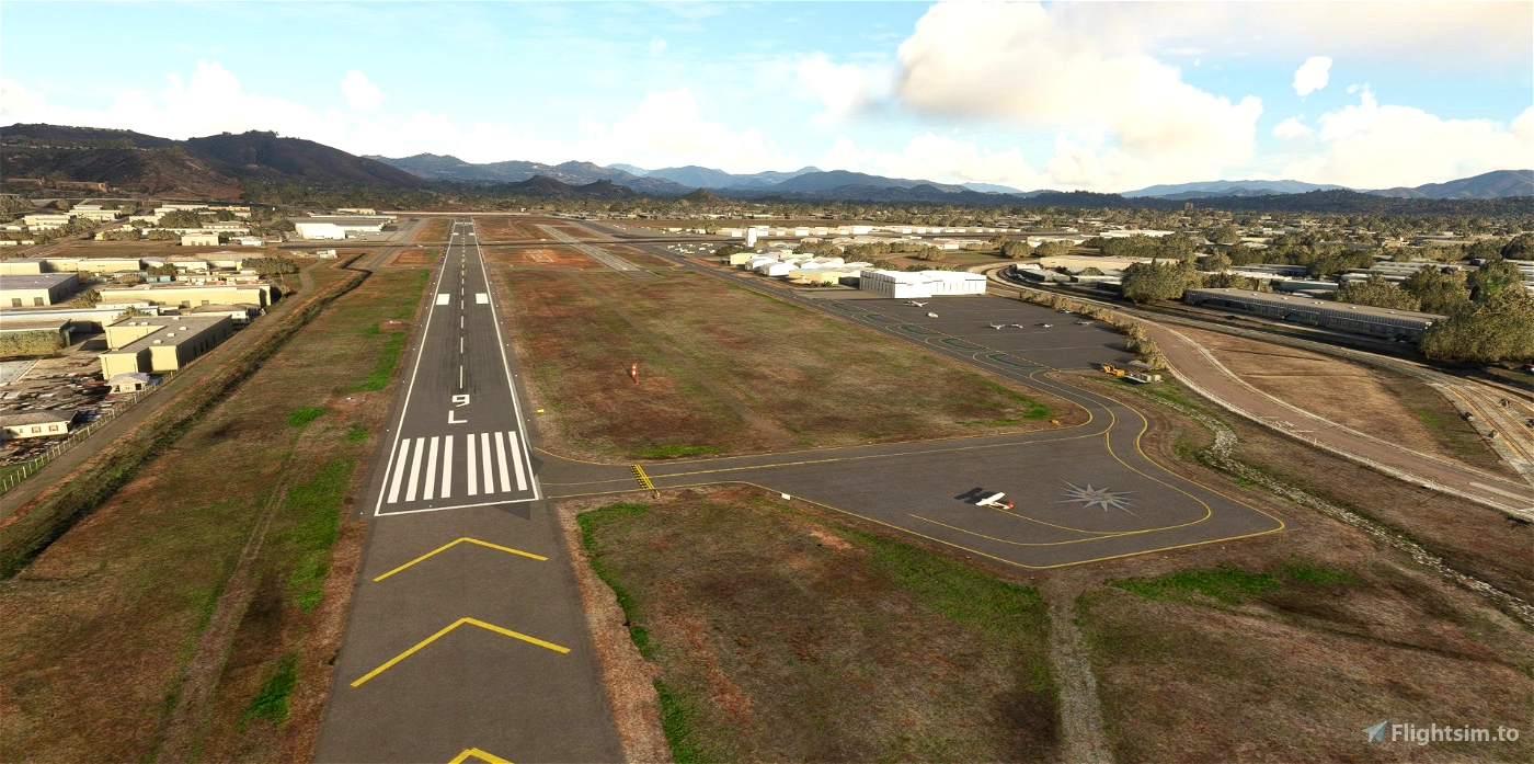
- Apron: the new extension of main apron (2023)
- Ground markings:
- Big TAXI yellow ground markings to avoid confusion with runways 27R and 27L and handcrafted (amateur) red intersection runway.
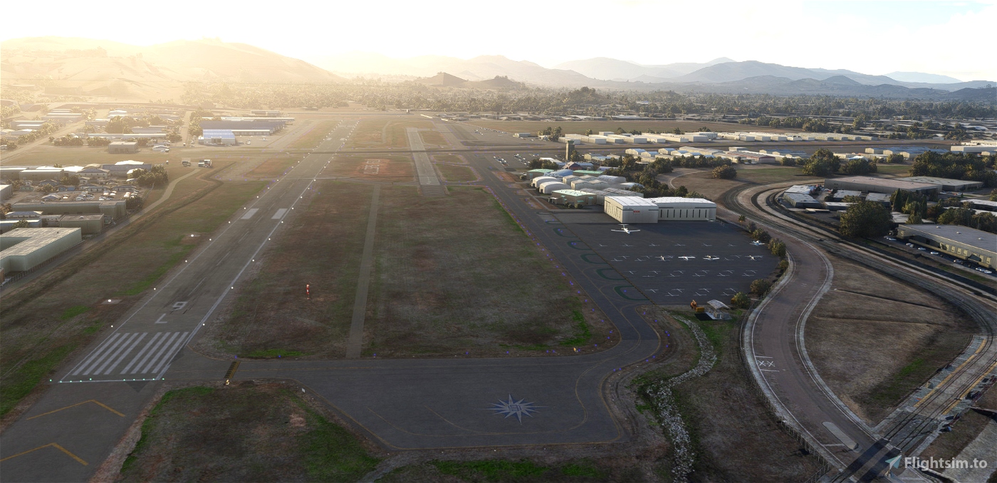
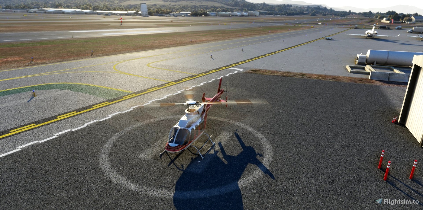
- Helipads at Mercy Air and on the transient apron north of the Terminal.
- Reveal of Compass Rose west of the field on D1
- Windsocks: correct placement and addition
- Night blue light poles: remove the maximum of undesired extra poles
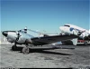
- Static aircrafts at ASTREA (stock Bell 407), Stearman at the Airpark and Skycrane at High Perf FBO from E.Baranger (https://sketchfab.com/helijah/models).
- No extra library or depedencies required.
How to install? Unzip the file into your Community folder. Keep the folder structure from the zip (\AirportServices \ContentInfo, \MaterialLibs, \scenery, layout.json and manifest.json at the root directory). Once installed go to KSEE as usual, the scenery is overlayed over the existing default one.
If you love the San Diego area, please consider my other scenaries:
- KMYF Montgomery Field: https://flightsim.to/file/5856/montgomery-gibbs-exec-airport-taxiway-fix-and-many-more
- KSEE Gillespie: https://flightsim.to/file/36679/gillespie-field-ksee
- KRNM Ramona : https://flightsim.to/file/25710/ramona-krnm
- KOKB OceanSide : https://flightsim.to/file/37328/oceanside-box-maxwell-memorial-airfield-kokb
- KSDM Brown Field: https://flightsim.to/file/38035/brown-field-muni-kdsm
- L08 Borrego : https://flightsim.to/file/38247/san-diego-borrego-valley-l08
- L77 Chiriaco Summit : https://flightsim.to/file/54957/chiriaco-summit-airport-l77
- L18 Fallbrook Community Airpark : https://flightsim.to/file/63441/fallbrook-community-airpark-l18
- L54 Agua Caliente: https://flightsim.to/file/66221/agua-caliente-springs-l54
- L78 Jacumba: https://flightsim.to/file/66976/jacumba-airport-l78
- The Bush Trip "San Diego VFR Transition" : https://flightsim.to/file/6276/vfr-transitions-at-san-diego
Work-In-Progress
- Some missing taxiway signs (see "Request / I need you" below")
- Parking spots (orientation) should be verified.
Requirements
- Free stocked MSFS : Sedona
- World Update II (USA) and X (USA)
Requests
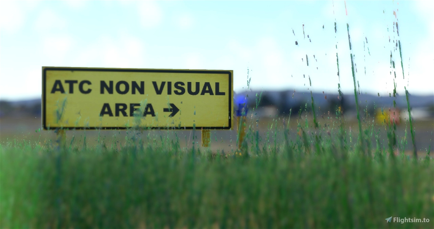
I need you : there're several specific signs on taxiways that I found like "ATC NON VISUAL AREA", "Be a Good Neighbor". These make the scenery unique and I look for others I was unable to identify. If you have pictures, feel free to share with me!
Not included: attention to night environment.

 vbazillio


18 days ago
RhettKelly
My only complaint is the usage of the stock MSFS models for the static aircraft. These are killer on frame rate with the quantity you have added, please consider a version which utilizes lower fidelity models such as UK2000. Thanks!
2 months ago
2 months ago
vbazillio
vintageripstik
3 months ago
jvortiz56
4 months ago
4 months ago
vbazillio
RayProudfoot
7 months ago
7 months ago
vbazillio
SeriousRotate
7 months ago
7 months ago
vbazillio
FlyingDutch
8 months ago
7 months ago
vbazillio
fppilot
9 months ago
9 months ago
vbazillio
mikced76
9 months ago
9 months ago
vbazillio
bwc1976
Thanks for improving and keeping all your work up to date. I enjoy computer flying in the San Diego area. I read all the signs you add. I've never had any compatibility issues with your work. You work is pay ware quality. Thanks again for your time and contribution to the Sim.
10 months ago
FlyingMarc
Thanks for all the updates you do ...
10 months ago
Brytskiva
salut, encore un bijoux...j'avais omis de te coller des strars
10 months ago
PAPYDANIEL66
Awesome addition and amazing work with the accuracy! Would you mind please adding parking to Golden State Aviation in the next update or at your earliest convenience where I fly out of as a student so I don't have to taxi over there every time?
10 months ago
Thank you for your message! I'll update KSEE, in few minutes, with this parking spot, hope it's ok : https://i.imgur.com/xSKsAbt.jpeg
As a local, if you can support the scenery by providing better resolution picture of these two signs I can't hardly identified (picked from youtube videos) : https://i.imgur.com/RMAmuyK.png and https://i.imgur.com/TnvZ1um.png
10 months ago
vbazillio
CMDR_Wollfe
Thank You!
11 months ago
You're welcome! Your nickname "Ginete" reminds me "Ginette" the bar in IVAO Bora Bora island in early's 2000 when I discovered the IVAO French Polynesia community ;)
10 months ago
vbazillio
Ginete
my fps tanks when i load up in the transient areas
11 months ago
Sorry to hear that. Do you mean it doesn't happened when you start at another position in the field? And does it happened also with ONLY this scenery in the community folder?
11 months ago
vbazillio
iang