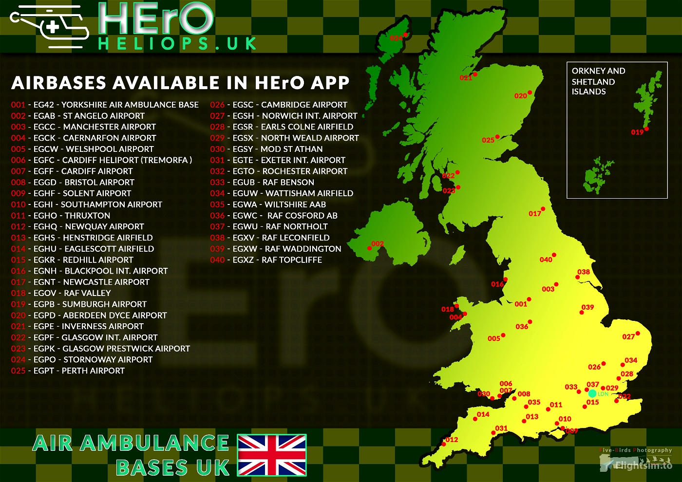
Hey Mates,
I like flying HEMS (Helicopter Emergency Medical Services) missions in MSFS and use the excellent App HErO from vHEMS. It is a lot of fun, but as only available currently in the UK, it was hard for me to know where the Airbases, which are used in the HErO App are located. I also thought it might be a great idea to collect all the nice liveries and sceneries for these airbases. So I decided to support HErO by designing a little interactive booklet (and map) to show where all the HEMS operations are currently available.
Inside the .zip file you will find three files:
- A color Map with all Airbases and Stations currently used by HErO app (DIN A3)
- A print friendly version of the map (DIN A3)
- An interactive pdf with information and links to the HErO app, used helicopter models, liveries and sceneries (DIN A3)
If you find some errors, please let me know. Also let me know if you made a charming HEMS livery or HEMS related scenery (e.g. Helipads and Airbases, no emergency scenery, as this is included with HErO App) and wants this to be included in the pdf.
Version History:
V1.0 - Booklet for HErO App - Air Ambulance Bases - UK
Initial release


looks awesome, although 001 should be Egcc Manchester not EG42 right?
2 years ago
Yes, there are some errors in it. But atm i am busy with Livery updates.
2 years ago
FiveBirds
4791
thank you for many entertaining hours. I hope you extend you excellent work to include other countries.
2 years ago
rogerb
Thank you for taking the time to do this.
Looks great!
2 years ago
Unstable
Wow !!
Just Exciting!!
This is excatly the addon I was waiting for.
The map is accurate and the links are very useful. If you agreed to put links to H135 Liveries, it would be perfect.
Thanks a lot : You did a very good Job !
2 years ago
Hi,
Thank you for your kind words. I will update the Booklet and if i find the time, i will also integrate the H135 Liveries so far.
2 years ago
FiveBirds
PiLVaLK